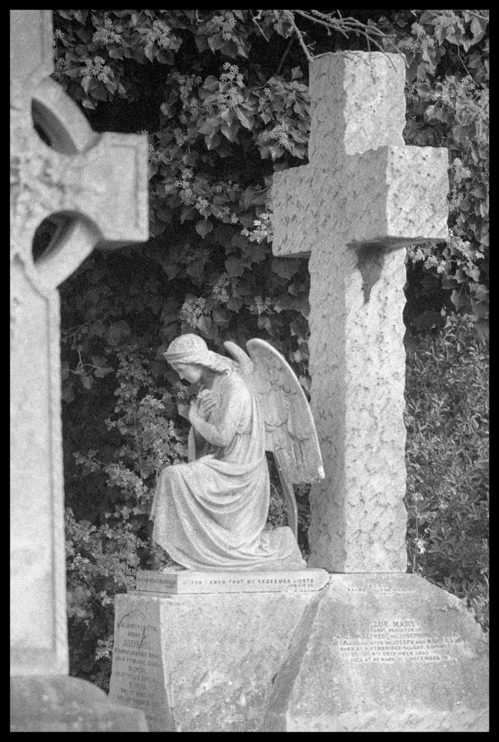
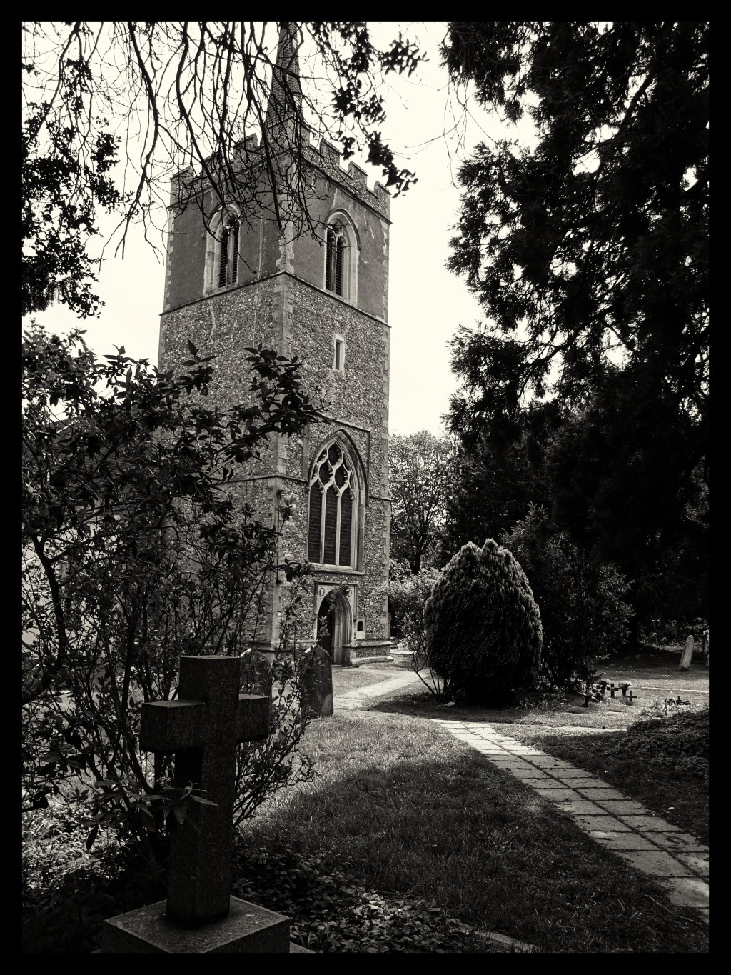
Two Cemeteries Photo Walk

In the first 50 years of the 19th century London’s population more than doubled from 1 million to 2.3 million. With the increased population came the added problem of what to do with the dead. The parish churches graveyards had become dangerously overcrowded and there were incidents of decaying matter from overcrowded graveyards getting into the drinking water supply and causing epidemics.

The answer was to create more private cemeteries outside central London. In 1832 Parliament passed an act encouraging such cemeteries. Over the following decade seven new cemeteries were established. These were Kensal Green (1833), West Norwood (1837), Highgate 1839-1860), Abney Park (1840), Brompton (1840), Nunhead (1840) and Tower Hamlets (1841).

The group at the entrance to Brompton cemetery at the start of the walk. This is a digital image.
My setup for the days shooting. Olympus OM2n. Zuiko 35-105 f3.5 zoom lens. Zuiko 135mm f2.8 lens. Ilford Delta 3200 Pro film. (digital image)

Looking for a location for a walk with the London Film Photography group on Meetup I thought a cemetery might be good for some atmospheric images. It might seem a bit morbid to some but our old cemeteries are a great location for statues and textures on the graves. They can even be quite good for some nature shots.

So, this month we set off firstly to Brompton Cemetery. Designed by Benjamin Baud, it was designed to be an open air cathedral with an impressive central colonnade leading to a domed Chapel. Not the oldest but the 39 acres is full of monumental statuary and is the resting place for the suffragette leader Emmeline Pankhurst and public health pioneer John Snow to name a few. They also have a nice little cafe at the North Lodge entrance.

The weather held out for us with just a few spots of rain but it did mean we had some interesting cloud in the sky.

The equipment that I used was my Olympus OM2n and the Zuiko 135mm f2.8 lens and the Zuiko 35-105 f3.5 lens. I started off with the film that was already in the camera, a Fomapan 200, which proved to be a bit slow for the overcast weather. I also had with me a roll of Ilford HP5+ and a roll of Ilford Delta 3200 Pro. I was keen to try out the Delta 3200 and shoot it at 1600 iso as I thought the graininess of this fast film would suit the subject matter. It would also mean that I could use a filter on the lens to improve the sky rendition and the contrast. As I was using a telephoto lens I also wanted a fairly fast shutter speed. Al the imags in this article are shot on the Ilford Delta 3200, shot at 1600 and developed in Rodinal for 28 minutes at 20 deg c.

We spent an hour and a half at Brompton which proved to be not long enough to explore the 39 acres so it looks like we will have to go back again.

A lot of patience was required to capture the crows!

After lunch at the North Lodge cafe we set off further north for Kensal Green cemetery.

Built in 1833, Kensal Green is the oldest of the public cemeteries now known as the Magnificient Seven and includes in its now the resting place of HRH Duke of Sussex and his sister Princess Sophia. At it’s heart is the Greek Revival Anglican Chapel and the landscape includes 161 designated monuments and other structures.

We spent another hour and a half at Kensal Green but again this proved to be not long enough to explore a lot of it’s 77 acres of grounds. We ended our tour by going to a local pub before wending our various ways home after a very nice day.

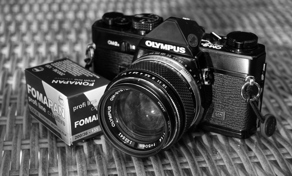
More on film. Fomapan 200.

During this second lockdown period I thought it would be a good opportunity to try out perfecting some new film photography. I’ve used Fomapan 400 a fair bit in the past but decided to try Fomapan 200 for a change. Maybe not the best idea during the dull weather we’re having just recently but at least I can get to using a large aperture and throwing the background out of focus.

So I decided to do our local walk which starts at a small church. I first had a look round the churchyard. Churchyards are always good for some texture and interesting light shooting.

The small Church of St Thomas’ at Perry Green, the start of our walk.
A misty day forming a drip on the tap gives it an extra element.
Detail of the church.

Further along our walk we pass the Henry Moore Studio and Gardens. Even though it’s closed at present there is an opportunity to still see some of the sculptures.

Large Figure in a Shelter by Henry Moore.
Hoglands, Henry Moore’s home and now a museum reflected in the visitor centre windows.

The walk takes us round the perimeter of the Henry Moore grounds and then along part of the Hertfordshire Way.

Along the Hertfordshire Way.
My favourite gatepost subject on the walk.

So, what of the film. I developed the Fomapan 200 for 13 minutes in Ilford ID11 at 20 deg C. Ilford ID11 is my go to developer at present. As it’s a powder developer it has an almost indefinite shelf life in it’s powder form so I can purchase a couple of boxes without having them go off before I can use them.

I quite like the tones of Fomapan 200 but not sure the grain appears to be much smaller than Fomapan 400 and I have to say that I think I prefer to use Ilford HP5+ for most of my photos.

Olympus OM2n and Fomapan 200.

I will though try the Fomapan 200 out with another camera/lens combination. This set was photographed using the Olympus OM2n fitted with the 50mm f1.4 lens. I intend to run another 36 through my Pentax Spotmatic fitted with the 55mm f1.8 Takumar lens.

Legacy glass on digital Part 1.

Carl Zeiss Jena 29mm f2.8 Lens.

I do like the quality and feel of the old legacy lenses created for the old film cameras. To my mind they are built to a higher standard than the modern lenses made for the consumer market.

I recently saw a Carl Zeiss Jena 29mm lens advertised on ebay and was tempted and was surprised that no one else bid on it. So, I got myself a nice lens of good condition for £31.

There is a lot written about the company of Zeiss Jena and the fact that it was situated in the Eastern part of Germany after the second world war. The company Zeiss originated in Jena but after the war the Americans moved most of the staff and manufacturing to Oberkochen in the West of Germany. Optics were continued to be manufactured in the original factory in Jena and in some cases using the original technicians who chose to stay. Some would say that the quality of the Jena lenses doesn’t match that of the ones produced in Oberkochen but I think there is an element of snobbery in that statement. It may be that the quality control was a bit more relaxed at the Jena works but if you get a good example they are certainly good lenses.

Carl Zeiss Jena 29mm f2.8.

You are, of course, stuck with manual focus when using these lenses on a digital camera but that doesn’t bother me at all. I often use manual focus with my digital lenses. On a Micro Four Thirds camera the focal length for this lens is 58mm which is a good focal length for Street Photography. The lens also has a close focus distance of 0.25m which is better than my Leica 25mm digital lens. I also like the way these old lenses have all the distance scales etc etched on the lens. It’s very handy for when you’re doing zone focusing, again, not something easy to do on a lens with no distance markings.

The lens fitting is the 42mm screw fit so I had to purchase a new adaptor for my micro four thirds cameras (Olympus OM-D E-M1 and Lumix GX8).

K & F Concept M42 – M4/3 adaptor

I chose the K & F Concept adaptor as I had purchased others in the past and some had been problematic and fitted the Lumix camera but not the Olympus. The one I chose was the Pro version which is a couple of pounds more expensive but was of excellent build quality and finish. It fitted both cameras very accurately without any play.

K & F Concept M42 – M4/3 adaptor

The lens and the adaptor look very good mounted on my Olympus OM-D.

Olympus OM-D M1 fitted with K & F Concept adaptor and Carl Zeiss Jena 29mm f2.8 lens.

I mounted the lens to my Lumix GX8 and went out for an afternoon photographing in a small town called Saffron Walden in Essex. These are some of the results. All jpgs straight out of the camera with no post processing:

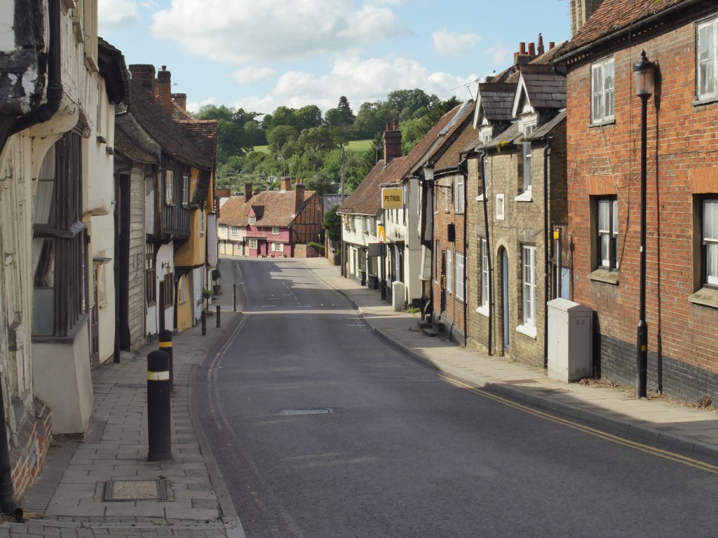
Walk – Wareside – 3.25 miles.

A very pleasant walk from The Chequers pub in Wareside and along the River Ash. This route follows in part along the old Buntingford branch line which went from St Margarets to Buntingford. Opened in 1859 and closed in 1964.

The walk starts at the Chequers pub in Wareside. If it’s not busy you can park up in the village hall car park beside the pub. Leaving the car park you walk down and turn right beside the pub along the B 1004. Just after this you turn right up the lane signposted to Babbs Green.

Start of the route in Wareside. Turn right just after the cottage on the right.
Looking back at the start at The Chequers pub.

After a few yards up this lane you have to decide whether to turn left up the narrow path immediately to the right of the Bourne Cottage. Alternatively you can continue up the lane to the next set of crossroads where you turn left. Ths time we walked up the lane to the crossroads. Immediately opposite is the old Wesleyan Church, now turned into houses. This property has some history for me as it was purchased by an uncle of mine in the mid sixties after attendance to the services had dropped to an all time low. It was converted by him to houses and remained in the family for some time.

Wesleyan Church (former), Wareside now Wesleyan House.

After turning left at the crossroads you continue up the narrow road and eventually the footpath mentioned earlier and the road join. At the small triangular green turn right and continue up the road until you arrive at Morley Pond. Morley Pond Cottages have another connection with my family as it’s where my grandmother once lived. It’s a pity I couldn’t get a photo but there was a number of vans parked out in the drive obscuring the cottage. At this point continue straight up next to and left of the cottages along a rough surfaced lane. This lane continues on between hedges. In due course the lane drops downhilll and comes out near a couple of farms. Continue on bearing left along the farm drive with Newhole Farm on your left.

Newhole Farm.

The view looking North East just after Newhole Farm.

The road continues on until you get to the B1004 where you cross over and continue on down another farm track. Continue down this track toward Watersplace Farm. Just before the farm turn left to follow track down the right hand side of the field toward the river Ash.

The left turn at Watersplace Farm.

Follow the hedge to your right and then at the end of the hedge turn back on yourself round the hedge and walk back with the river on your left until you reach the bridge.

Crossing the bridge over the River Ash.

Cross the bridge and continue straight across the field ahead of you to the gate.

Looking back toward the bridge over the River Ash,

After going through the gate turn left and follow the track of the old railway.

Looking right as we walk along the old railway track.
The River Ash.
Gate latch detail.
Part of the old railway road bridge. This is close by where the old Mardocks station was which served Wareside.
Inquisitive cows.

Just before the old railway road bridge turn right to descend down to another bridge that crosses the river. The turn left through a gate to walk along fields on the right hand side of the river. You go through another gate and field and then the path turns left over the river and returns across allotments back to the village.

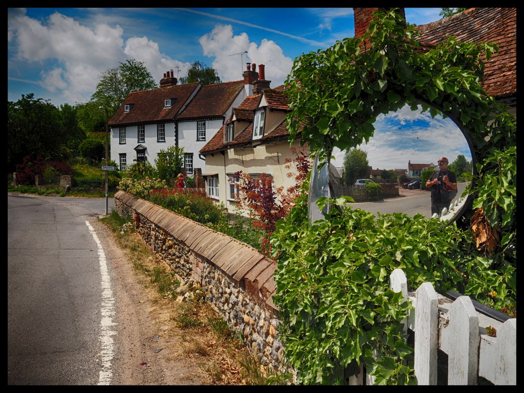
Stapleford Walk – Along the River Beane – 3.2 miles.

A very nice 3.2 mile walk starting at St Mary the Virgin church in Stapleford near Hertford.

You can start by parking along the road next to the school in Stapleford. Then walk down the road toward the River Beane and on the way visit the mid 12th century church of St Mary the Virgin.

The church is of flint rubble, cement render with stone dressings, stock brick buttresses and with an interesting weatherboarded tower.

The front of the church.
The view of the back of the church.

Walking through to the back of the church, the walk can be accessed by continuing to the back right hand corner of the graveyard and through a gate to continue alongside the River Beane and along a stretch of The Hertfordshire Way (Start). The path is a gravel path with easy walking. There are a couple of benches along the path where one can stop and take a rest.

The walk continues along the path by the river and at one point there is a wood on your left (Foxleys Wood). At this point the path goes slightly uphill to the left of the wood until you arrive at a gate and a barn on your right (point A). At this point, turn sharp left down the farm drive.

(Point A) After this gate turn left down the farm drive.

The walk continues along this surfaced farm drive past the wood which is now on your left. After some time the farm drive arrives at the road (Point B). Continue straight across the road onto another surfaced foot path.

The continuation of the footpath and South End Farm Cottage.

Continue on along this farm drive which eventually starts going slightly downhill toward the river again. If you wish to take a slightly shorter route you can turn left at Point C just after South End Farm which will take you downhill to rejoin the return leg of the walk at Point E.

The drive drops down toward the river.

At this point (point D) turn left through the gate shown and continue up the field track over the hill toward the wall and the gate through and continue along the path alongside the river. The path continues alongside the river and you end up at the road where you parked.

The lovely path alongside the River Beane on the return leg.

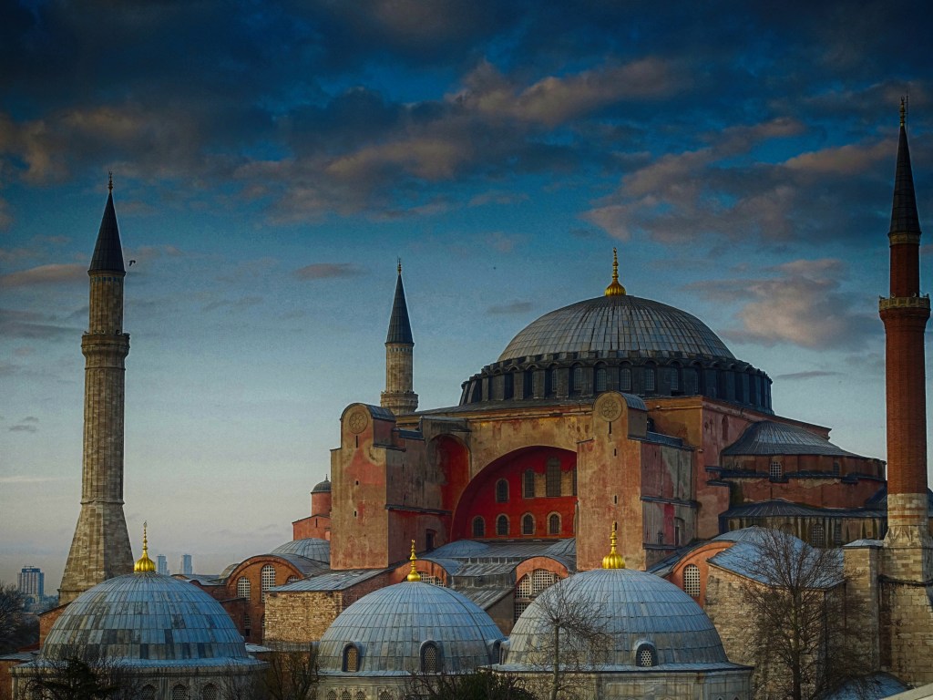
The life of a Street photographer during lockdown.

Another day of restricting ourselves of travel. Another walk locally.

We are able thankfully to walk in areas of open space at the edge of our estate and keep ourselves away from others. This walk through the tracks and lanes of the countryside has become my new ‘Street’.

Around the turn of the 15th Century, Thorley Manor acquired one of its most illustrious Lords, Sir Richard Whittington. As the legendary Dick Whittington, three times Lord Mayor of London, he made most of his fortune lending money in the City of London. His name, however, now lives on at Richard Whittington School and on Whittington Way. Popular folk lore likes to adopt the successive cats that frequent the church as the local descendant of Dick’s famous cat!

Our walk starts at the local church of St. James the Great, Thorley Church.

Originating in the 13th Century the church gained it’s most prominent feature, in the 15th century. The the church tower, built in the Perpendicular style. The evidence that church towers were still thought of as defensive locations is shown by the ornamental battlements and the extra heigh provided by successive storeys. Thorley’s design of tower with a thin eight sided spire or spike rising direct from the tower is a church feature peculiar to Hertfordshire.

The use of the top of the tower as a vantage point has a modern significance. It was used in the Second World War as a look-out place to watch for the night-flying Lysander aircraft returning to Sawbridgeworth airfield at Allen’s Green less than two miles away.

Moving on down into the valley our ‘Street’ takes us past some old barns, now used by industry.

Down into the valley with the weather closing in!
Down the valley and looking back to the church and the industrial buildings.

On over a small bridge over a stream to follow the valley floor.

The little bridge over the stream.
There’s still some late blossom.
Through a stile!

Back across the fields to the church and home again.

Istanbul Day 1 and 2

Day 1 – March 5th

Each year on my birthday month I tend to go somewhere for a short city break. This year I chose Istanbul in Turkey. It seemed like too good an offer to pass over with 6 nights including flights and transfers from the airport for a little over £400.

The journey from Sabiha Gokcen International Airport, 30 miles South-East of Istanbul, to our hotel in Istanbul took around 1 1/2 hours including our driver getting into a scrap at a busy junction with a yellow cab driver. The timely arrival of a policeman on a motorbike broke up the two characters rolling around on a bonnet of the yellow cab throwing punches at each other. Fortunately the policeman didn’t arrest the cabbies and cart them off so we could continue our journey.

Eminonu where the boats depart along the Bosphorous

With all it’s mix of cultures and the changes throughout the ages to it’s architecture I thought it would be an interesting place to visit, and I wasn’t disappointed.

The area known as the Hippodrome, once a gigantic stadium which stood at the heart of the Byzantine city of Constantinople. It is now an elongated garden and an area where people can promenade.

Istanbul wasn’t at that time showing any cases of the virus but we were scanned at the airport when we arrived by a thermal camera which should show anyone with a temperature.

Across the Hippodrome with the German Fountain. Built to commemorate the visit of the German Emperor Wilhelm II visit.

Formerly known as Byzantium and Constantinople and with over 15 million inhabitants, the city stands in a position between Europe and Asia. The city is split by the Bosphorous Strait which connects the Black Sea with the Sea of Marmara. As the only sea route between the oil-rich Black Sea and the Mediterranean, the Bosphorus is one of the busiest waterways in the world.

Strolling up the street from the Hipodrome to our hotel at the end of the day.

We had a small but very comfortable hotel, The Hotel Perula, just a few minutes walk up a street from the Hipodrome and ideally located for all the tourist attractions.

Located in the Hippodrome is the Egyptian Obelisk which was built in 1500 BC and stood outside Luxor. It was brought to Constantinople by the Emperor Constantine.

We spent the rest of the first day on a short walk around the Hippodrome and the surroundings to get our bearings.

Day 2 – March 6th.

we decided to visit firstly the underground water reservoir called the Basilica Cistern followed by the two local mosques. The Basilica Cistern dates from the reign of Justinian in the 6th century. It consists of a vast underground cavern used to store the water which runs down from the nearby mountains in the vast underground where the roof is held up by 336 columns, each over 8 metres tall.

The inside of the Basilica Cistern.

Following our visit to the Cistern we firstly visited the Haghia Sophia mosque, then Suleymaniye, commonly known as the Blue Mosque.

There were plenty of people posing for shots with the Haghia Sophia in the background.
A selfie on the run!
Another view of the German Fountain.
One of the many cats in Istanbul.
Roasted chestnuts and sweetcorn.
Haghia Sophia mosque.

After wandering round the Hippodrome we vsited the Haghia Sophia mosque. The security here at the entrance is very stringent and I had my mini tripod taken from me. I should have had it in my bag rather than attached to the camera.

Interior of Haghia Sophia.
Interior of Haghia Sophia

The interior of Haghia Sophia was a little disappointing as they are obviously doing some serious refurbishment and there is a lot of scaffolding up but then at over 1,400 years old I guess it’s not surprising.

Our second visit was to Suleymaniye mosque, commonly known as the Blue Mosque.

A view of the blue mosque from the Hippodrome.
Interior of the blue mosque.

Built between 1609 and 1616 the blue mosque is known as such because of it’s blue iznik tiling on the interior. As the Haghia Sophia, this mosque is a little disappointing as it has quite a lot of restoration going on. I think I still managed to get some good shots using my fisheye lens.

Interior of the blue mosque. The amount of scaffolding on the right hand side and the rectangular covering of the columns is a little disappointing.

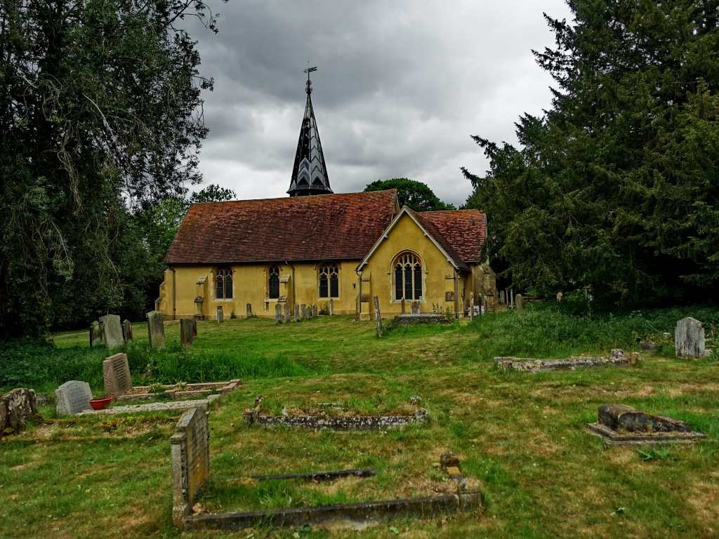
St Peters Church, Little Hanningfield.

From evidence in the north wall, the parish church of St Peter’s originated in the late 12th or early 13th century. The windows and glass reflect the history of the church and its time.

HISTORY: The nave is late C11 or very early C12 in origin. The chancel is of uncertain medieval date, but may be late C12 or early C13. The nave was lengthened to the west and possibly widened to the south in the C15, when the bell turret was also built. The south porch is also of this date, and the nave roof may be contemporary. The chancel was party rebuilt in 1850, and the church was further restored in 1883-4 by Frederic Chancellor (1825-1918), a well known church architect who worked widely in Essex and was mayor of Chelmsford seven times from 1888.